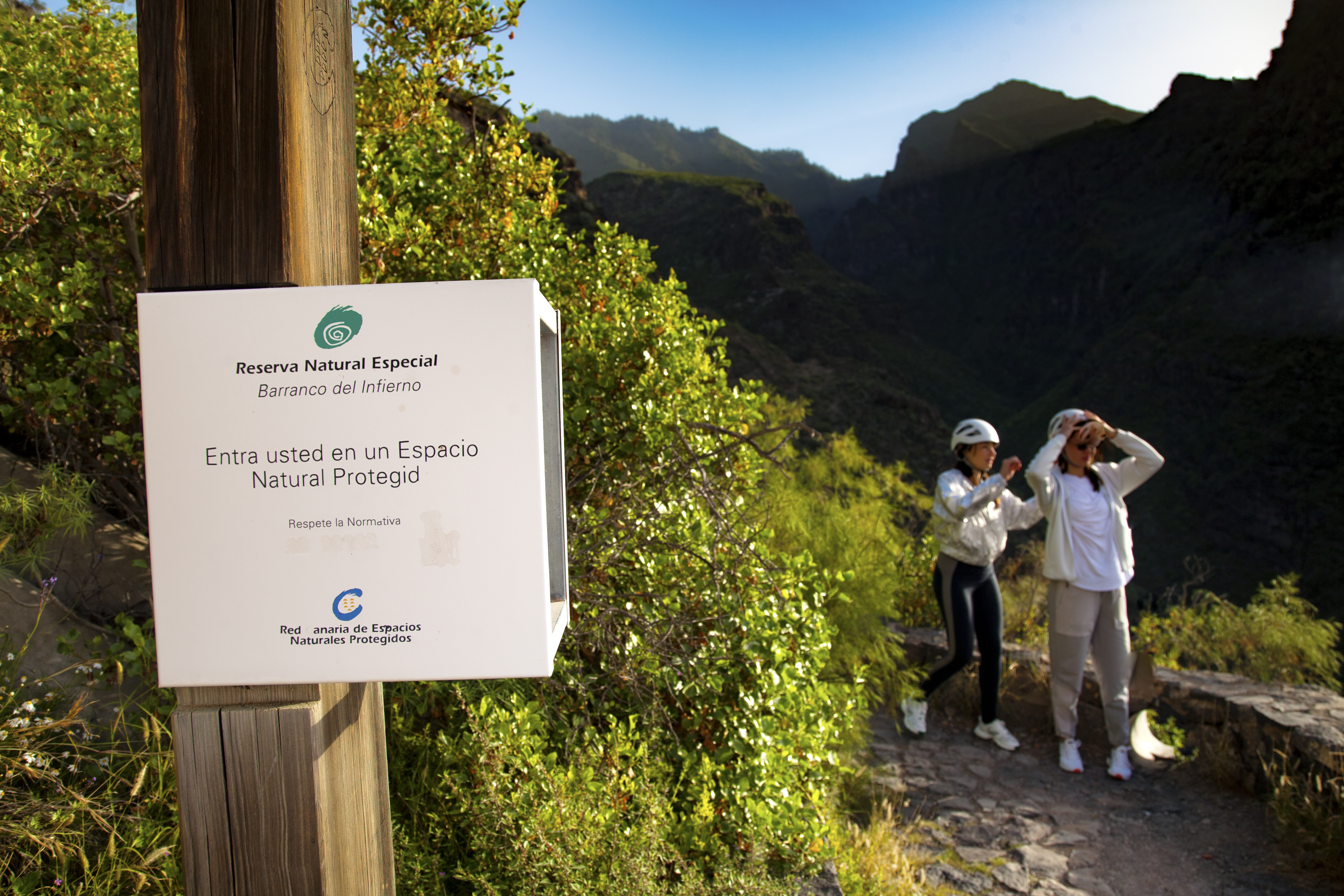
ePrivacy and GPDR Cookie Consent management by TermsFeed Privacy Policy and Consent Generator Barranco del Infierno Trail

Barranco del Infierno Trail

Adeje

Difficulty: Medium

Description

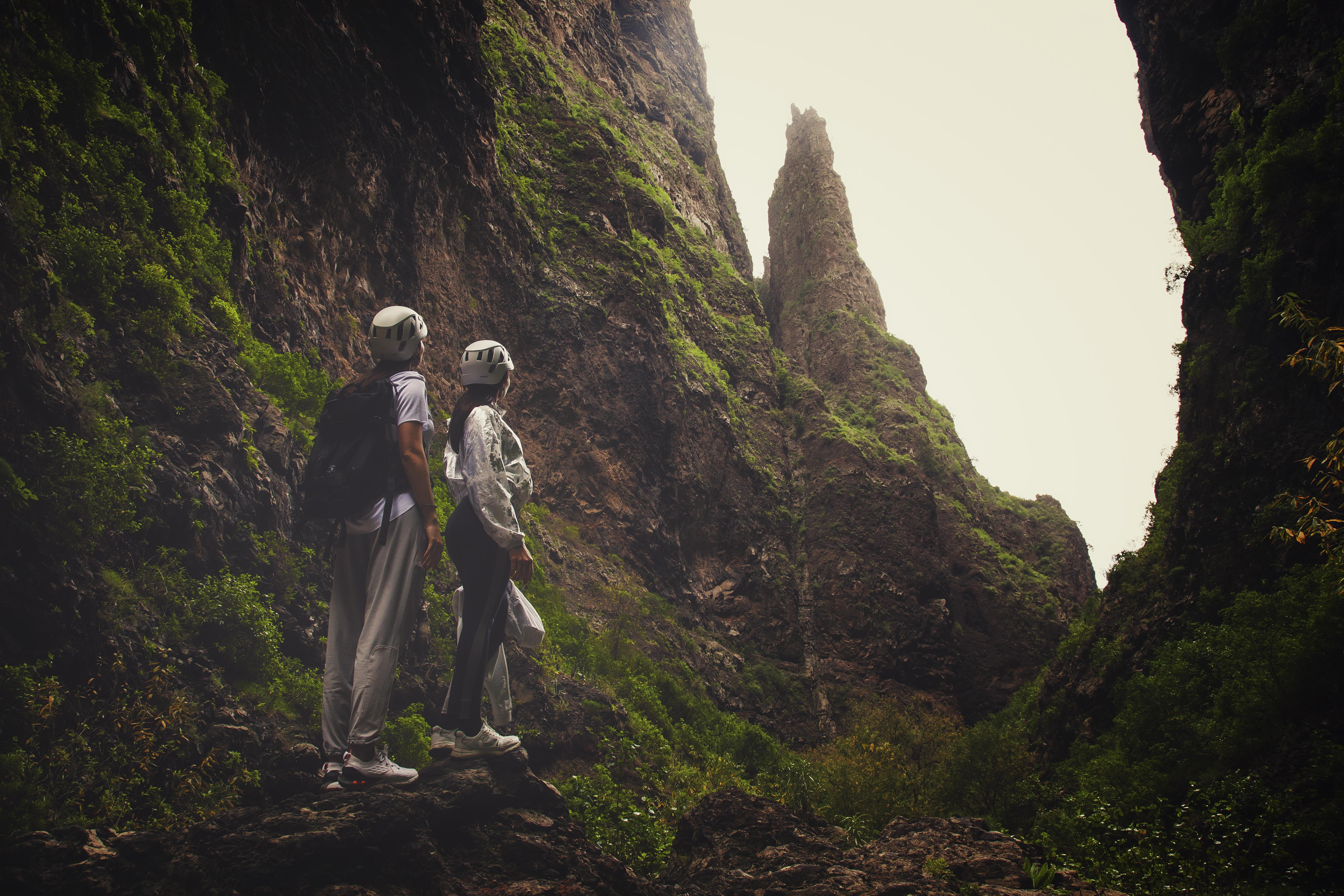
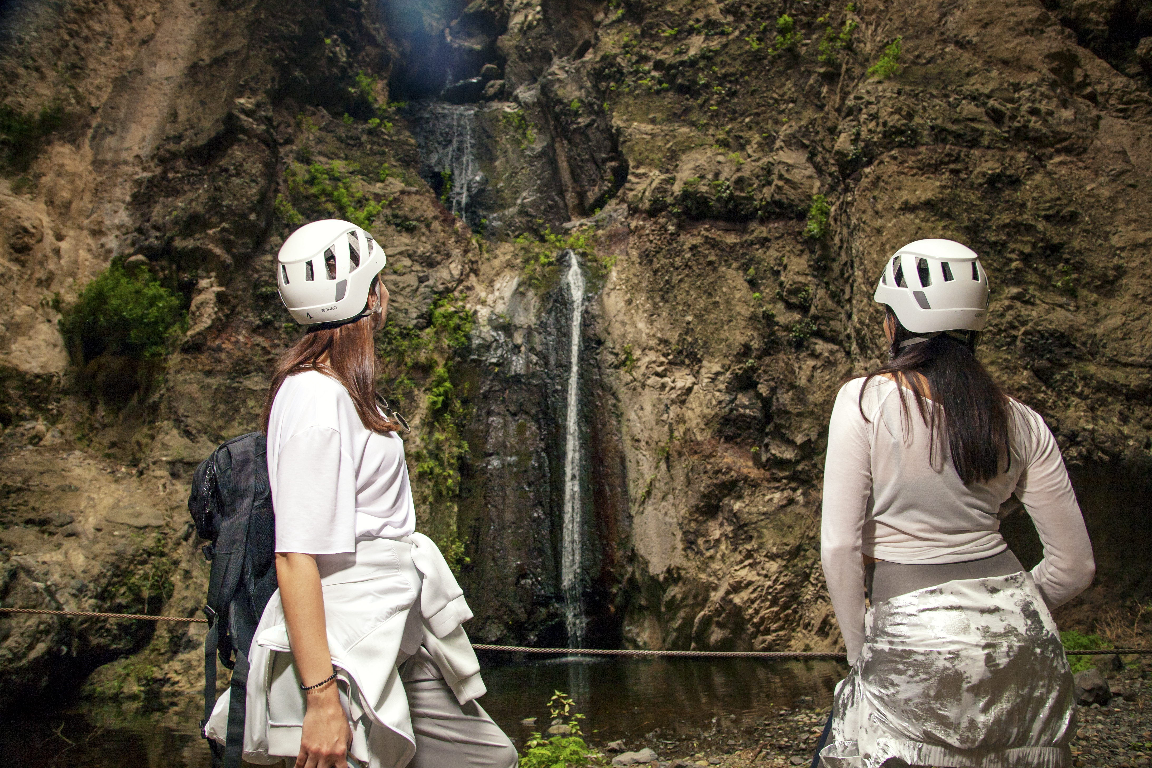
The Barranco del Infierno trail runs through the Special Nature Reserve of the same name, from the village of Adeje to a 200-metre high waterfall.

The trail, of medium difficulty, is 6.5 km long (out-and-back) and takes about 3.5 hours to complete.

The route takes you through groves of cardón or Canary Island spurge (Euphorbia canariensis) and tabaiba (Euphorbia balsamifera, Euphorbia lamarckii) in the lower areas, and then through the pine forests that dominate the higher sections. It is a good trail for bird lovers. If you are quiet and keep your eyes open, you might see kestrels, sparrow hawks, long-eared owls and Barbary partridges on the way. You have a better chance of seeing them if you take a pair of binoculars.

Access is limited to 20 people every 30 minutes in the morning, in order to preserve the natural space and guarantee the safety of visitors. It is therefore compulsory to book in advance via this link and to follow the visitor rules.

Tips

  • Always stay on the marked trail and do not enter private property, hunting grounds, water galleries, wells or caves.  
  • Pay special attention when crossing or walking along trails used by bicycles, horses or motor vehicles and when walking in ravines with water courses.
  • Avoid direct encounters with potentially dangerous animals, such as livestock, beehives, and dogs. 
  • Proceed with caution and watch for obstacles, loose rocks, uneven terrain or steep slopes to avoid accidents and falls. 
  • Check out our guide to hiking in Tenerife and, if necessary, contact the emergency services by calling 112.
Recommendations and tips

Guides

Barranco del Infierno website.- Link

Permits

Booking is compulsory through the Barranco del Infierno website, where you can also check the status of the path before you set off.

More information

Technical information sheet

Route information

Walking route

Tenerife ON

Out-and-back

3,00 km

2 h 5 m *

Check your fitness level

  • Altitude gain:522,10 m

  • Altitude loss:322,26 m

  • Maximum altitude:612,57 m

  • Minimum altitude:350,87 m

Signage

Wooden signs with place names and interpretation panels.

Signage

Route map and profile

Elevation profile

Difficulty

Medium *MIDE safe mountain criteria

  • Maximum altitude:612,57 m

  • Minimum altitude:350,87 m

Connections with other routes

How to get to route start point

Calle de los Molinos, 46, Adeje

No public transport service in the area.

No parking spaces in the area.

How to get to route end point

Barranco del Infierno waterfall

Only accessible on foot.

Only accessible on foot

Municipalities passed through

  • Adeje

Protected Areas

Transit

Reserva Natural Especial del Barranco del Infierno

The Barranco del Infierno Special Nature Reserve, in the south-west of Tenerife, is home to a water resource that is of particular importance for the rest of the ...

Discover the Protected Area
Reserva Natural Especial del Barranco del Infierno

Weather

Today, tuesday, in Adeje


Clouds
Wind

24 km/h

Temperature

18ºC Maximum

17ºC Minimum

Rain

0%

3 day forecast

wednesday

17ºC Maximum

14ºC Minimum

thursday

19ºC Maximum

14ºC Minimum

friday

19ºC Maximum

15ºC Minimum