ePrivacy and GPDR Cookie Consent management by TermsFeed Privacy Policy and Consent Generator Rambla de Castro Trail

Rambla de Castro Trail

Rambla de Castro

Difficulty: Low

Description

The Rambla de Castro Trail is a 4 km route that links the San Pedro and El Burgado viewpoints, on the north coast of Tenerife.

It is a low-difficulty route, with no major elevation changes, and features a combination of cobbled sections, dirt tracks and traditional footpaths.

Although the walk can be done in both directions, we recommend starting at the El Burgado viewpoint, in the street named Camino del Burgado, and finishing at the San Pedro viewpoint, where you will find more public transport options to return to Puerto de la Cruz.

From the first viewpoint, El Burgado, you can see Los Roques beach and the “mortalón”, a rock formation created during the landslide that formed the Orotava Valley.

The surface layer of this type of deposit is impermeable, allowing water to accumulate and rise to the surface at various points.

From here you can finish the route by following the signs until you reach Hacienda de Castro, next to the San Pedro viewpoint.

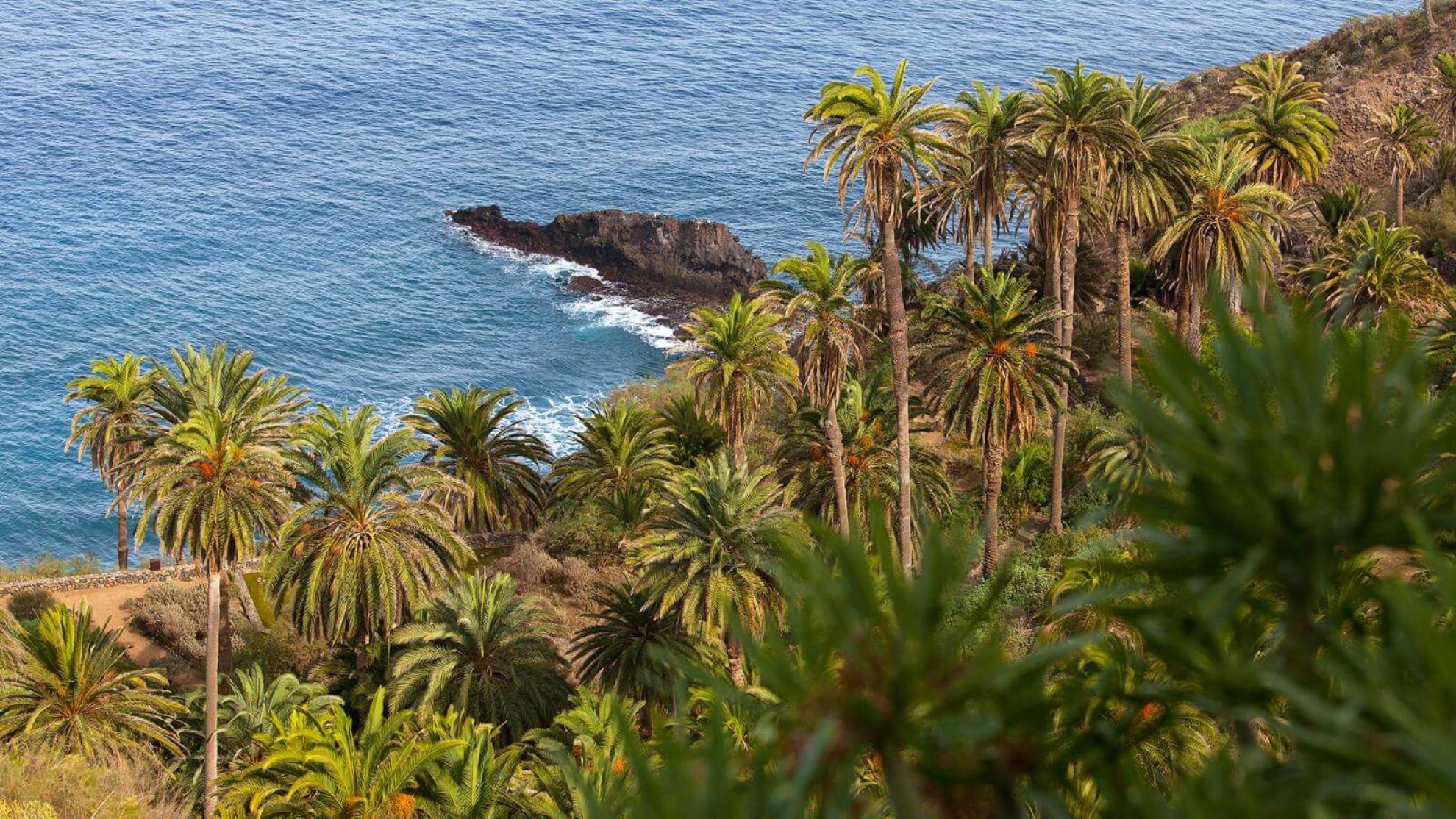
At this place you can learn about geomorphology, see large numbers of nesting birds and visit one of the few remaining palm groves in the north of the island.

Along the way, you will also have the opportunity to discover:

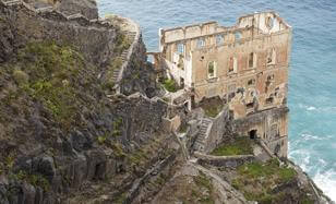
  • The ruins of the old Elevador de Aguas de Gordejuela, the first water pumping station in Tenerife to use a steam engine.
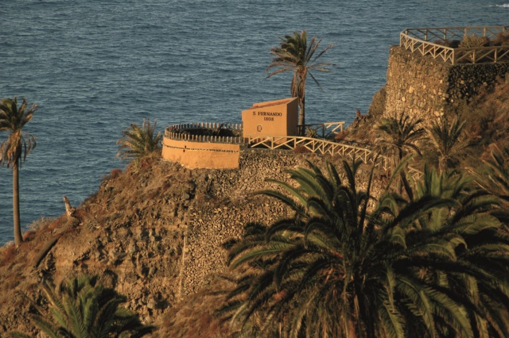
  • The San Fernando fort, from the end of the 18th century.
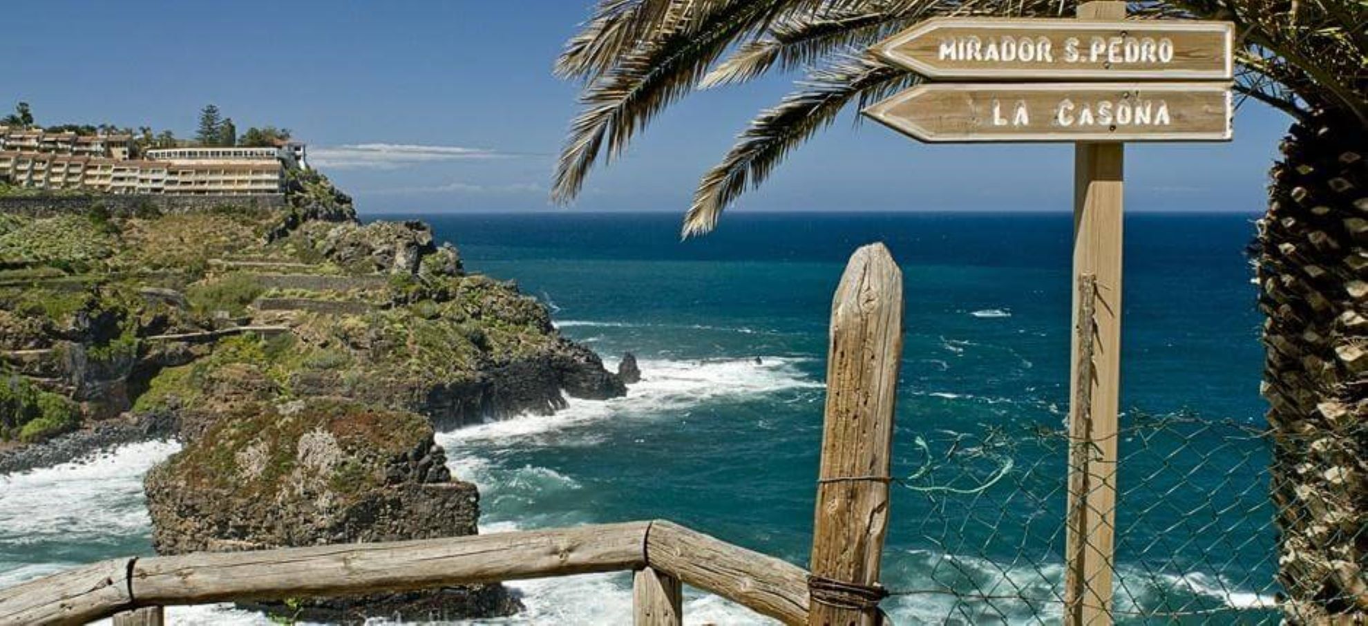
  • The important historical legacy of La Casona, former residence of the Castro family.
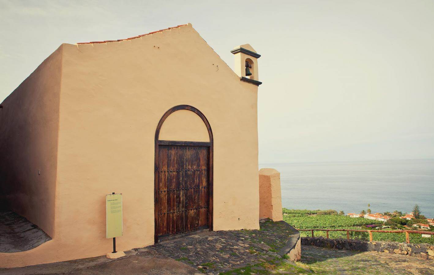
  • The San Pedro chapel, from the early 16th century.

Tips

  • Always stay on the marked trail and do not enter private property, hunting grounds, water galleries, wells or caves.
  • Pay special attention when crossing or walking along trails used by bicycles, horses or motor vehicles and when walking in ravines with water courses.
  • Avoid direct encounters with potentially dangerous animals, such as livestock, beehives, and dogs.
  • Proceed with caution and watch for obstacles, loose rocks, uneven terrain or steep slopes to avoid accidents and falls. 
  • Check out our guide to hiking in Tenerife and, if necessary, contact the emergency services by calling 112.
Recommendations and tips

Guides

No data available

Permits

  • Application form must be submitted by public or private non-profit entities (schools, associations, sports clubs, etc.). Please email This email address is being protected from spambots. You need JavaScript enabled to view it..
  • Authorisation required for public or private for-profit entities, via this link
  • Free access for all other visitors, no reservation required.
More information

Technical information sheet

Route information

Walking route

Tenerife ON

Linear

4,36 km

1 h 50 m *

Check your fitness level

  • Altitude gain:312,44 m

  • Altitude loss:231,78 m

  • Maximum altitude:147,22 m

  • Minimum altitude:45,31 m

Signage

Wooden signs with the name and direction of the route.

Signage

Route map and profile

Elevation profile

Difficulty

Low *MIDE safe mountain criteria

  • Maximum altitude:147,22 m

  • Minimum altitude:45,31 m

Connections with other routes

No data available

How to get to route start point

Mirador El Burgado, Camino del Burgado, 4, Los Realejos.

Bus number 381, Maritim bus stop code 4929. TITSA

Parking spaces limited.

.

How to get to route end point

Urbanización Rambla del Mar, under Mirador de San Pedro, Los Realejos.

Bus numbers 330, 363 and 546 about 400 metres from the viewpoint, San Agustín bus stop code 4330. TITSA

Parking spaces limited at the viewpoint.

Municipalities passed through

  • Los Realejos

Protected Areas

Transit

Paisaje Protegido de la Rambla de Castro

La Rambla de Castro was declared a protected landscape because of its beauty, the value of its ecosystems, and its cultural significance on the ...

Discover the Protected Area
Paisaje Protegido de la Rambla de Castro

Weather

Today, wednesday, in Los Realejos


Clouds
Wind

0 km/h

Temperature

25ºC Maximum

22ºC Minimum

Rain

610%

3 day forecast

thursday

24ºC Maximum

20ºC Minimum

friday

25ºC Maximum

19ºC Minimum

saturday

25ºC Maximum

20ºC Minimum

Places of interest

These are some of the points of interest you can find along this route.

Unique building

Fortín de San Fernando

Small 18th-century fortress built to defend the coast from attacks, which still preserves three...

Unique building

Ermita de San Pedro

The Hermitage of Saint Peter the Apostle was built in the first decade of the 17th century, next...

Unique building

La Gordejuela Pumping Station (Casa del Agua)

Ruins of the old Gordejuela water elevator, where the first steam engine used to pump water in...