ePrivacy and GPDR Cookie Consent management by TermsFeed Privacy Policy and Consent Generator SL TF 296 La Mesa

SL TF 296 La Mesa

SL-TF 296

Valle de Güímar

Difficulty: Medium

Description

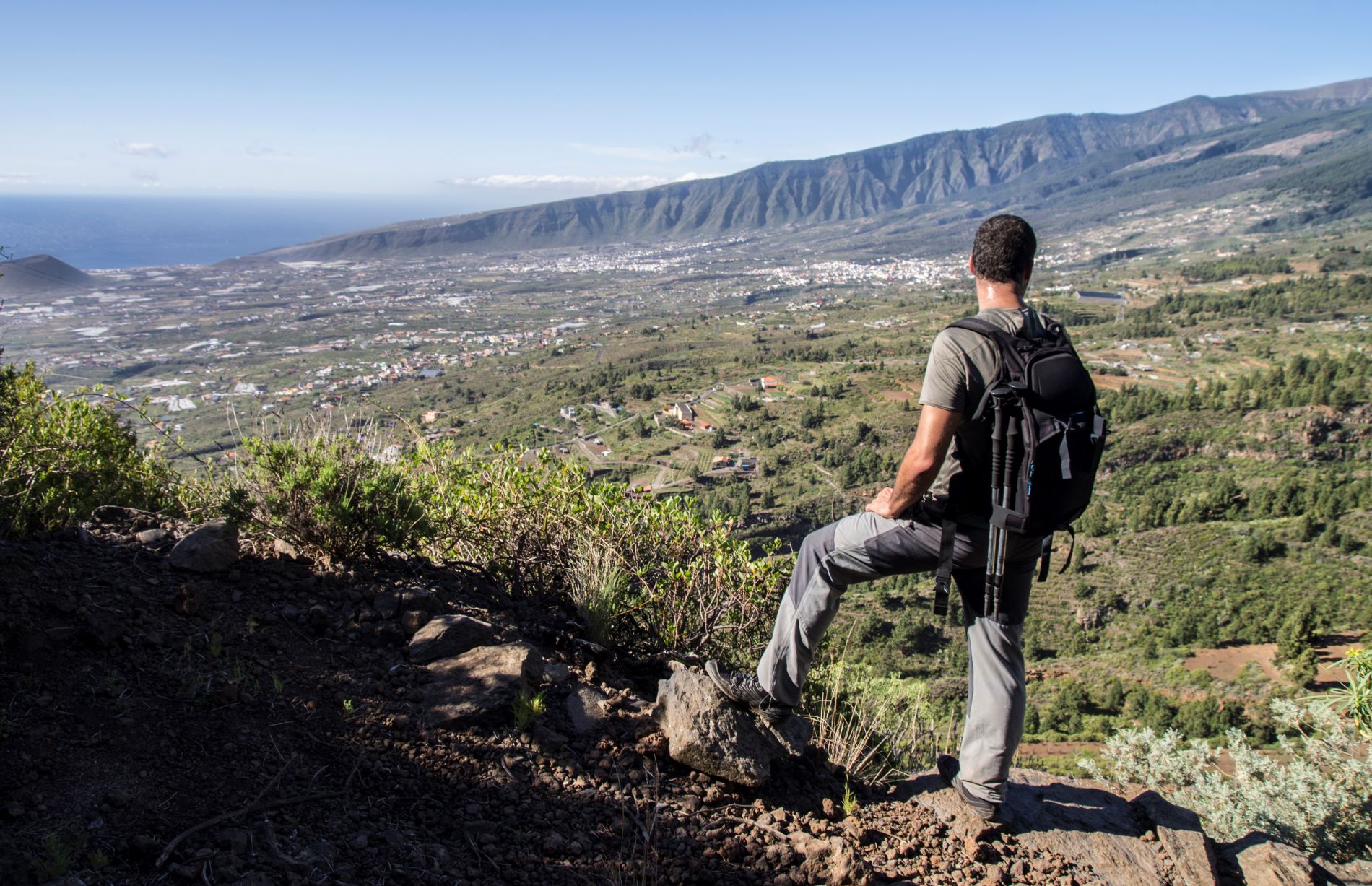
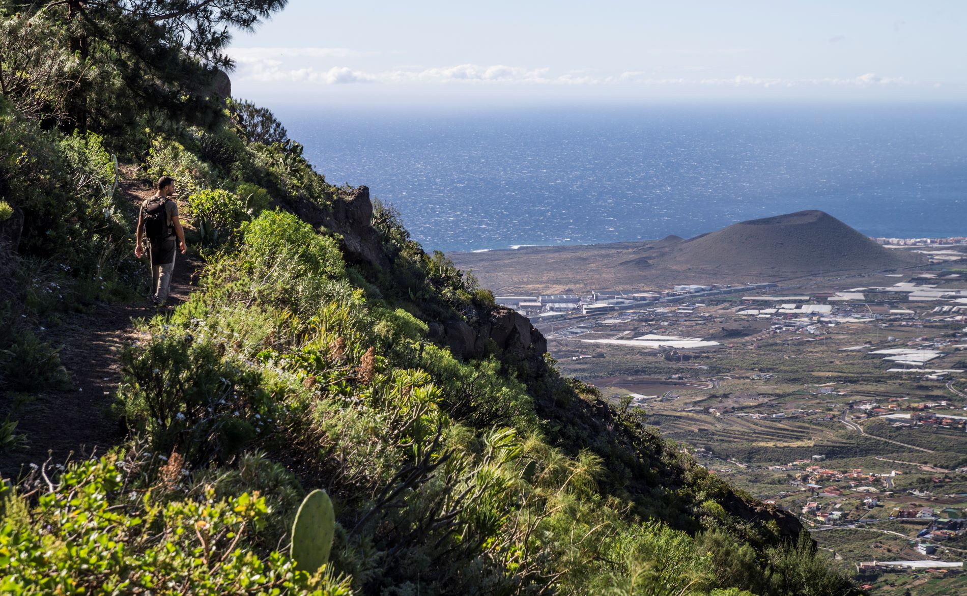
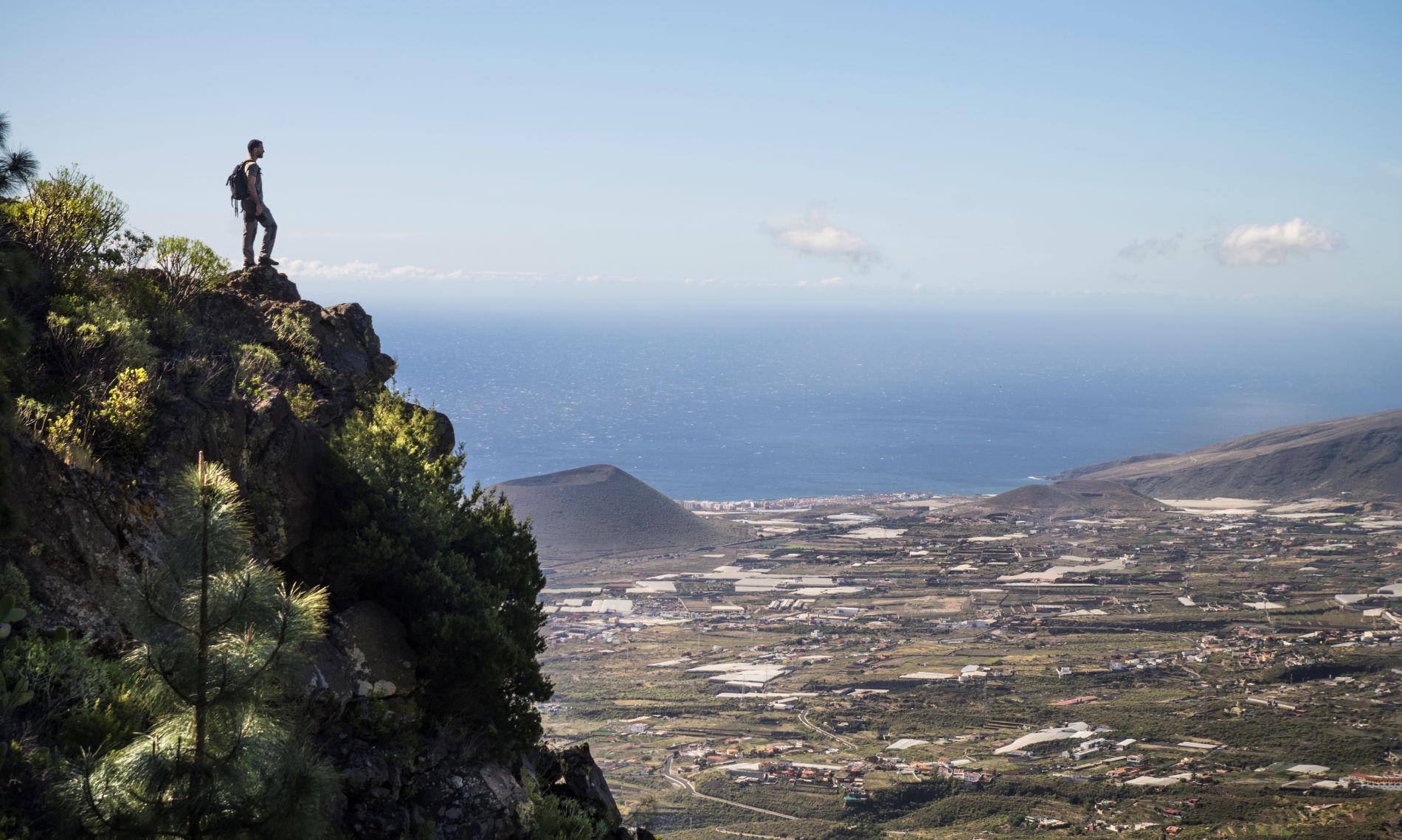
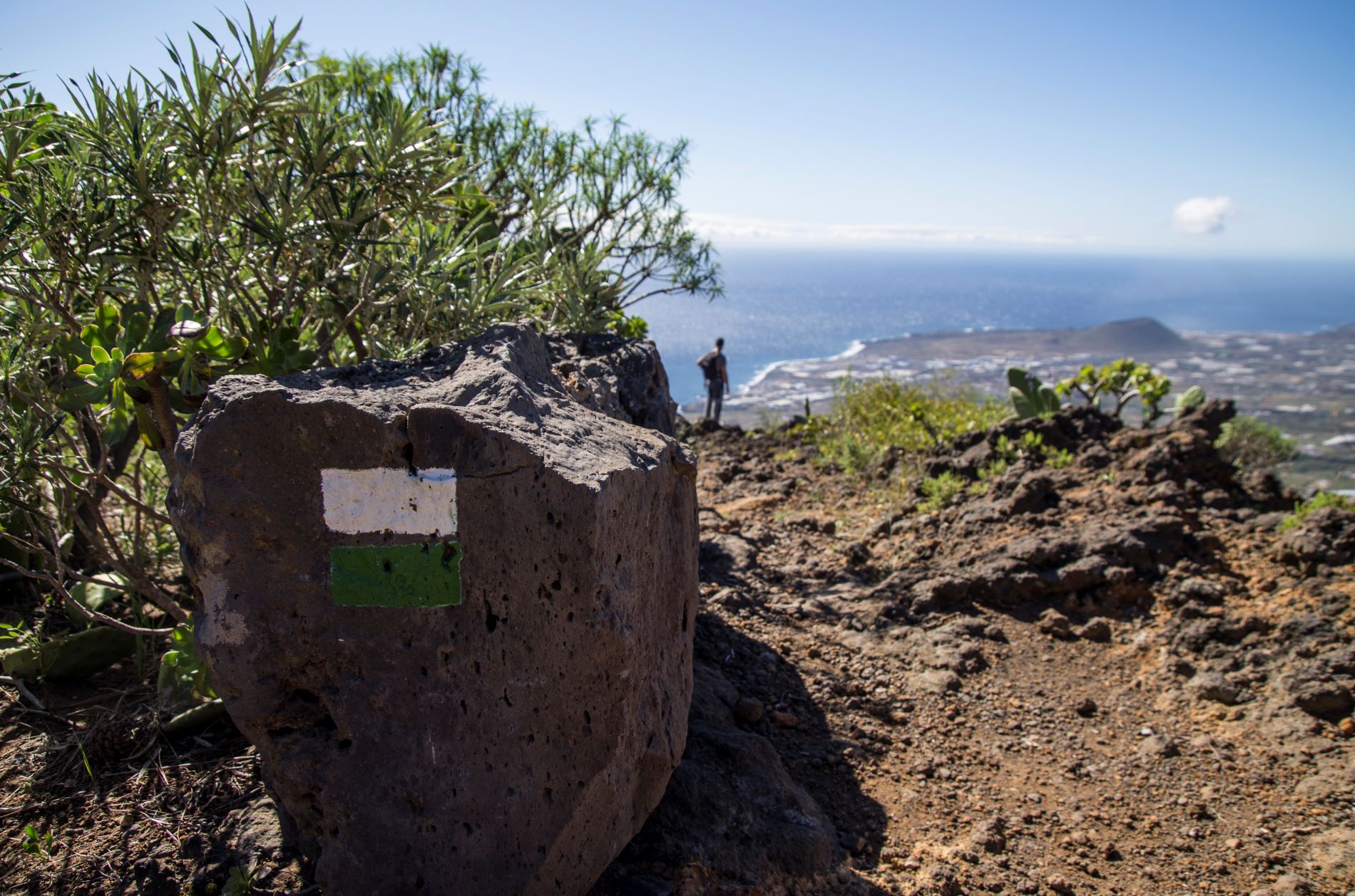
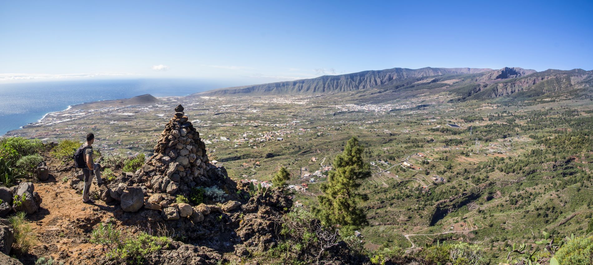
La Mesa offers magnificent panoramic views of the Güímar Valley and leads you deep into the Corona Forestal Natural Park.

Along the route you will be able to spot some of the most representative species of native and endemic flora of our tabaibal-cardonal and pine forest ecosystems, along with traces of the agricultural and livestock farming practices that once flourished on these lands, characterised by cereal crops, fruit trees and vineyards.

The route begins in the Barranco de La Florida ravine, in the village of Araya. From there it climbs up to Finca de Las Haciendas, a place of great heritage value due to its traditional Canarian buildings.

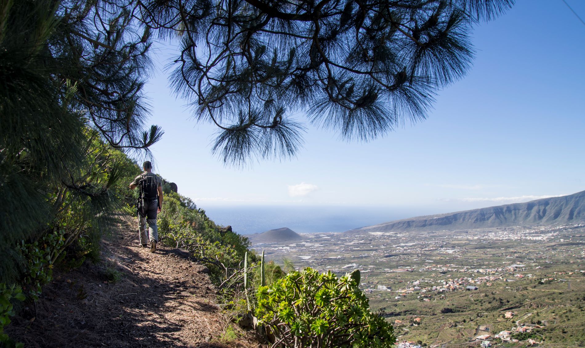
As you advance through the Corona Forestal Nature Reserve, the Canary Island pine begins to take centre stage as the landscape transforms into pinewoods.

You will then reach Casa de La Mesa, located at an altitude of 550 metres. This 19th-century building was used by the people who worked these lands and includes a house, wine press, stable and farmyards.

From this point onwards, the path has several stone-paved stretches as it winds its way down to the mouth of the Chacorche ravine, in the village of Igueste de Candelaria.

This trail is approved in accordance with Decree 11/2005, of 15 February, which created the Canary Island Network of Trails and regulates the conditions for the organisation, approval and conservation of the trails of the Autonomous Community of the Canary Islands, which means that these trails are officially designated as footpaths for sports, tourism or recreational use in nature.

Tips

  • Always stay on the marked trail and do not enter private property, hunting grounds, water galleries, wells or caves.  
  • Pay special attention when crossing or walking along trails used by bicycles, horses or motor vehicles and when walking in ravines with water courses.
  • Avoid direct encounters with potentially dangerous animals, such as livestock, beehives, and dogs. 
  • Proceed with caution and watch for obstacles, loose rocks, uneven terrain or steep slopes to avoid accidents and falls. 
  • Check out our guide to hiking in Tenerife and, if necessary, contact the emergency services by calling 112.
Recommendations and tips

Guides

La Mesa trail leaflet from Candelaria Town Council.

Permits

  • [TEMPORARY MEASURE] Free access without authorisation or reservation for natural or legal entities of a public or private nature, both non-profit (town councils, schools, associations, clubs, etc.) and for-profit (active tourism companies), until 31 December 2024 as established in the Resolution.
  • Free access for all other visitors, no reservation required.
  • Email for enquiries - This email address is being protected from spambots. You need JavaScript enabled to view it.
More information

Technical information sheet

Route information

Walking route

Tenerife ON

Linear

6,64 km

3 h 5 m

676,09 m

842,03 m

One way with fitness level 3/5

  • Altitude gain:676,09 m

  • Altitude loss:842,03 m

  • Maximum altitude:805,87 m

  • Minimum altitude:174,86 m

Signage

Route code

SL-TF 296

Posts and signs displaying the SL code and green and white marks.

Signage

Route map and profile

Elevation profile

Difficulty

Medium *MIDE safe mountain criteria

  • Maximum altitude:805,87 m

  • Minimum altitude:174,86 m

Connections with other routes

How to get to route start point

Parroquia San Juan Bautista de Araya, Plaza de Araya.

Possibility of private transport if you contact the Candelaria Town Council shared taxi company.

Parking spaces available in the village.

How to get to route end point

Plaza Dimas Coello, Calle Ajoreña, Igueste de Candelaria.

Possibility of private transport if you contact the Candelaria Town Council shared taxi company.

Parking spaces available in the village.

Municipalities passed through

  • Candelaria

Protected Areas

Transit

Parque Natural de la Corona Forestal

The Corona Forestal is the largest protected natural area in the Canary Islands, one of the most extensive forests on the islands, the lungs of Tenerife and the gateway to Mount Teide.  As its name ...

Discover the Protected Area
Parque Natural de Corona Forestal

Weather

Today, saturday, in Candelaria


Clouds
Wind

7 km/h

Temperature

24ºC Maximum

20ºC Minimum

Rain

0%

3 day forecast

sunday

24ºC Maximum

21ºC Minimum

monday

25ºC Maximum

21ºC Minimum

tuesday

26ºC Maximum

22ºC Minimum