ePrivacy and GPDR Cookie Consent management by TermsFeed Privacy Policy and Consent Generator SL TF 294 Los Brezos

SL TF 294 Los Brezos

SL-TF 294

Valle de Güímar

Difficulty: Medium

Description

The Los Brezos loop trail takes you along the traditional footpaths linking Igonce, Los Brezos, Piedras de Carcho, El Luchón and Barranco La Gotera.

Most of the route runs through an area known for its agricultural activity in the upper reaches of the south-east of Tenerife.

Some of the most representative heritage features you will see along the way are water channels, drinking troughs, water sources, reservoirs and stone ovens for drying fruit. Along the route you will also pass Finca de Las Haciendas, a traditional Canarian building of great architectural value.

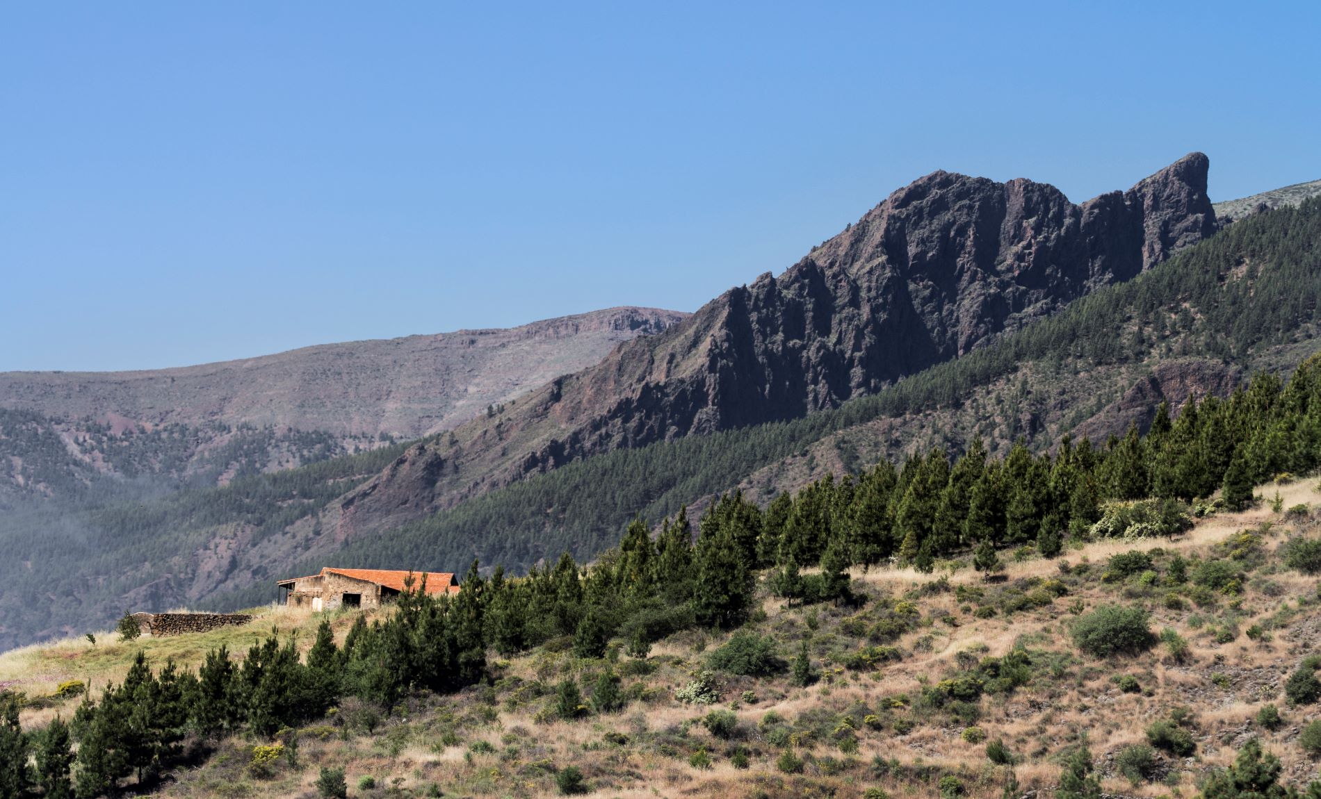
You will also be able to walk through the Corona Forestal Nature Reserve on the section that runs through Piedras de Carcho, and observe beautiful geomorphological features, such as the striking Lajas de Chafa.

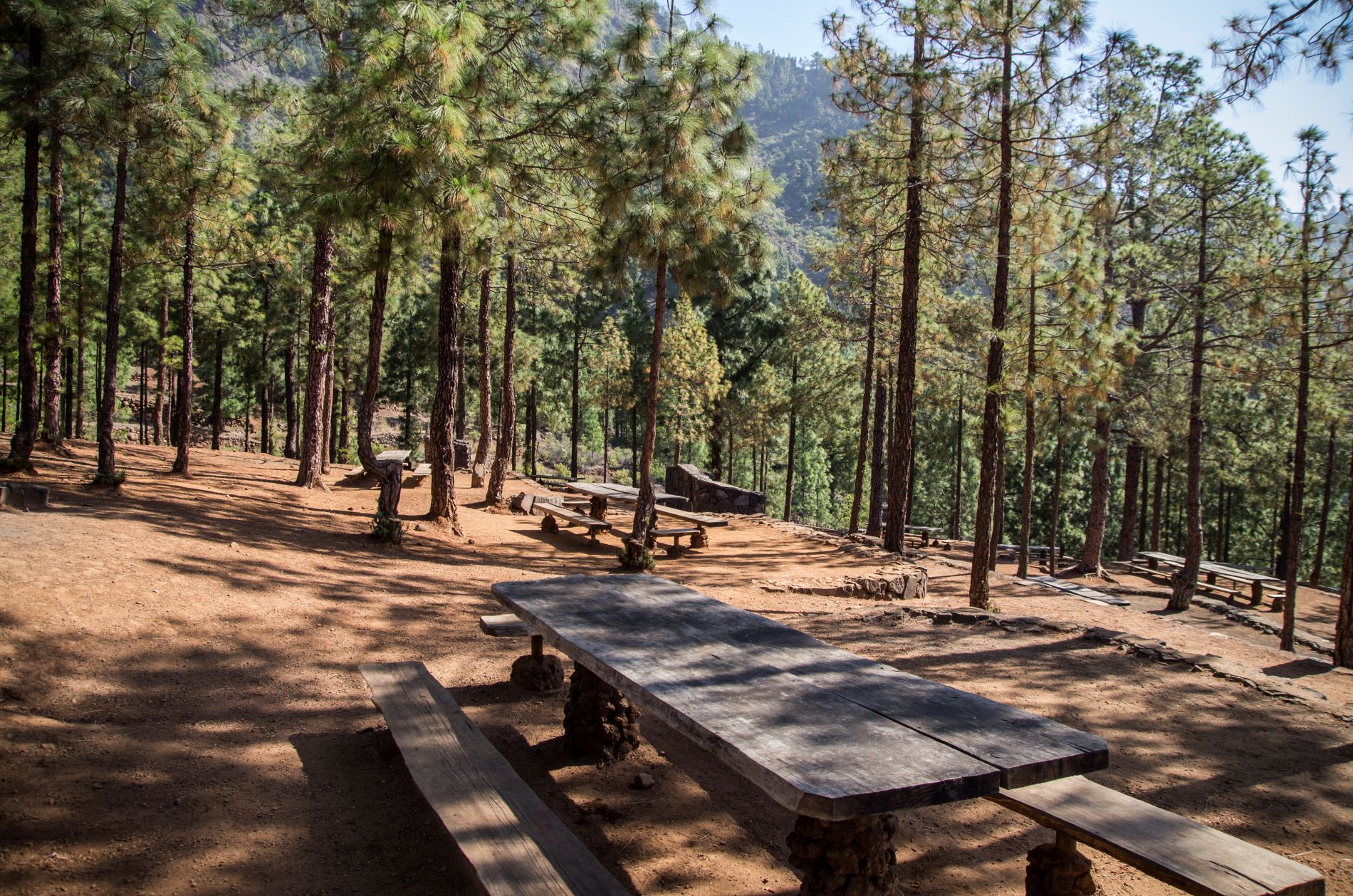
Moreover, as it is a circular route, you will have the option of walking it clockwise or anti-clockwise. You can even start the route from two different points: Cruz del Camino, in Araya, or the Los Brezos Recreational Area (out of service at the time of publication of this route).

This trail is approved in accordance with Decree 11/2005, of 15 February, which created the Canary Island Network of Trails and regulates the conditions for the organisation, approval and conservation of the trails of the Autonomous Community of the Canary Islands, which means that these trails are officially designated as footpaths for sports, tourism or recreational use in nature.

Tips

  • Always stay on the marked trail and do not enter private property, hunting grounds, water galleries, wells or caves.  
  • Pay special attention when crossing or walking along trails used by bicycles, horses or motor vehicles and when walking in ravines with water courses.
  • Avoid direct encounters with potentially dangerous animals, such as livestock, beehives, and dogs. 
  • Proceed with caution and watch for obstacles, loose rocks, uneven terrain or steep slopes to avoid accidents and falls. 
  • Check out our guide to hiking in Tenerife and, if necessary, contact the emergency services by calling 112.
Recommendations and tips

Permits

  • [TEMPORARY MEASURE] Free access without authorisation or reservation for natural or legal entities of a public or private nature, both non-profit (town councils, schools, associations, clubs, etc.) and for-profit (active tourism companies), until 31 December 2024 as established in the Resolution.
  • Free access for all other visitors, no reservation required.
  • Email for enquiries - This email address is being protected from spambots. You need JavaScript enabled to view it.
More information

Technical information sheet

Route information

Walking route

Tenerife ON

Circular

8,33 km

3 h 40 m *

Check your fitness level

  • Altitude gain:801,97 m

  • Altitude loss:801,97 m

  • Maximum altitude:1.071,35 m

  • Minimum altitude:467,89 m

Signage

Route code

SL-TF 294

Posts and signs displaying the SL code and green and white marks.

Signage

Route map and profile

Elevation profile

Difficulty

Medium *MIDE safe mountain criteria

  • Maximum altitude:1.071,35 m

  • Minimum altitude:467,89 m

Connections with other routes

How to get to route start point

2 access points available: 1.- Cruz del Camino, Calle la Morrita, Araya. or 2.- Los Brezos Recreational Area, Camino las Vichas, Candelaria.

No public transport in either area.

Possibility of private transport if you contact the Candelaria Town Council shared taxi company.

Limited parking spaces both in the village and at the recreational area.

How to get to route end point

2 access points available: 1.- Cruz del Camino, Calle la Morrita, Araya. or 2.- Los Brezos Recreational Area, Camino las Vichas, Candelaria.

No public transport in either area.

Possibility of private transport if you contact the Candelaria Town Council shared taxi company.

Limited parking spaces both in the village and at the recreational area.

Municipalities passed through

  • Candelaria

Protected Areas

Transit

Parque Natural de la Corona Forestal

The Corona Forestal is the largest protected natural area in the Canary Islands, one of the most extensive forests on the islands, the lungs of Tenerife and the gateway to Mount Teide.  As its name ...

Discover the Protected Area
Parque Natural de Corona Forestal

Weather

Today, friday, in Candelaria


Clouds
Wind

2 km/h

Temperature

24ºC Maximum

21ºC Minimum

Rain

0%

3 day forecast

saturday

25ºC Maximum

21ºC Minimum

sunday

25ºC Maximum

22ºC Minimum

monday

24ºC Maximum

22ºC Minimum