The definitive map for exploring outdoor leisure options in Tenerife
View the island’s trails, facilities and points of interest in just a couple of clicks from Tenerife ON’s interactive map
If asked where the heart of Tenerife ON is, our answer would be simple: the interactive map.
On the map you can see all the information about nature-based recreational activities on our island at a glance and use the different layers and options to quickly find what you are looking for.

How to customise your search using the interactive map
Map view
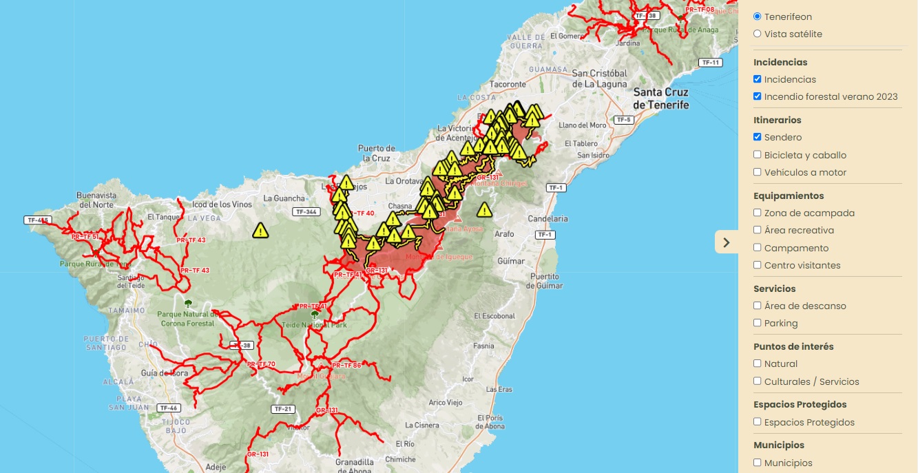
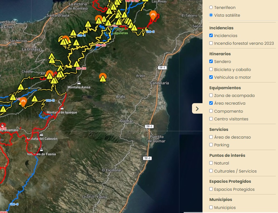
In the right sidebar, the first option given on the interactive map is a choice between:
- Tenerifeon: simple, intuitive and user-friendly standard map.
- Satellite view: orthophoto map that accurately displays the terrain.

Available layers
Also in the right sidebar and just below the map view options you will find all the layers that you can enable or disable to explore nature-based leisure options in Tenerife:
- Incidents: information about trails and facilities closed for safety reasons, works or landslides, and about the safety perimeter established during recovery efforts following the forest fire of Summer 2023.
- Trails: all the hiking routes on the island listed in Tenerife ON.
- Cycling and horse riding routes: signposted tracks for bicycles and horses in Tenerife ON.
- Network of tracks for recreational motor vehicles: signposted forest tracks where recreational motor vehicles are permitted.
- Camping area: all areas managed by the Tenerife Island Council where camping is permitted, both with tents and with motorhomes or campervans.
- Recreational areas: public areas managed by the Tenerife Island Council with basic services for recreational use of the island’s natural areas, such as enjoying a picnic with family or friends.
- Camps: 3 areas with cabins and facilities fitted out by the Tenerife Island Council as nature camps.
- Visitor centres: information points where you can learn about the natural areas where they are located, their history and the conservation work being carried out in the area.
- Rest areas: ideal spots to stop and rest on a trail and, on many occasions, to enjoy the scenery.
- Parking areas: parking spaces near facilities or trails where you can park your vehicle.
- Points of natural interest: natural features that are of special interest within the Tenerife ON network of trails, such as monumental trees, ravines and cliffs.
- Points of cultural interest/services: notable buildings associated with the Tenerife ON network of trails, such as museums, farmhouses and unique or historic buildings.
- Protected areas: areas of the island with specific categories of protection.
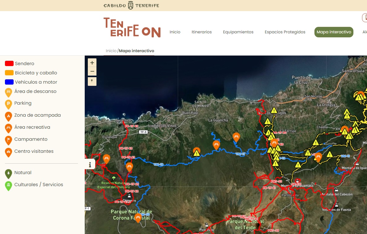
Legend
On the left you can see the legend that will help you to understand the information on the map.

Interactive resources
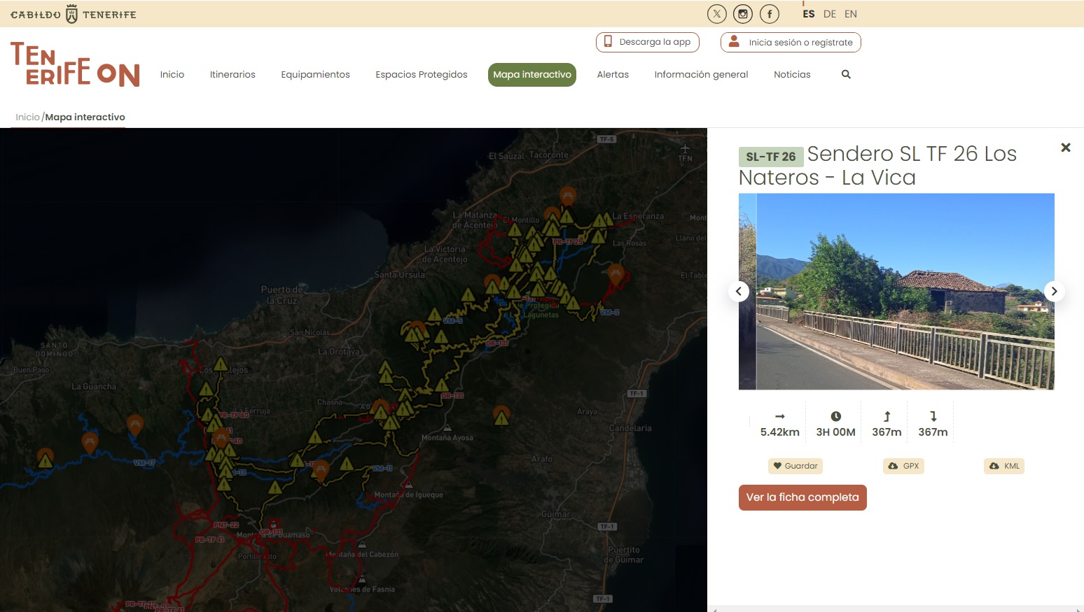
Once you have selected the layers that interest you, click on the resources that appear on the map to find out more about them.
When you do so, a window will pop out with a brief summary and a link to the route, facility or protected natural area associated with the resource that you clicked on.

Now that you know how to search with our interactive map and to customise your search using all the layers, why not make the most of it and plan your next outdoor adventure in Tenerife.
Enjoy!
And remember that, if you want, the App will guide you step by step, even when there is no network coverage. 😊


